Tracks4Africa - Wall Map of Africa

Couldn't load pickup availability
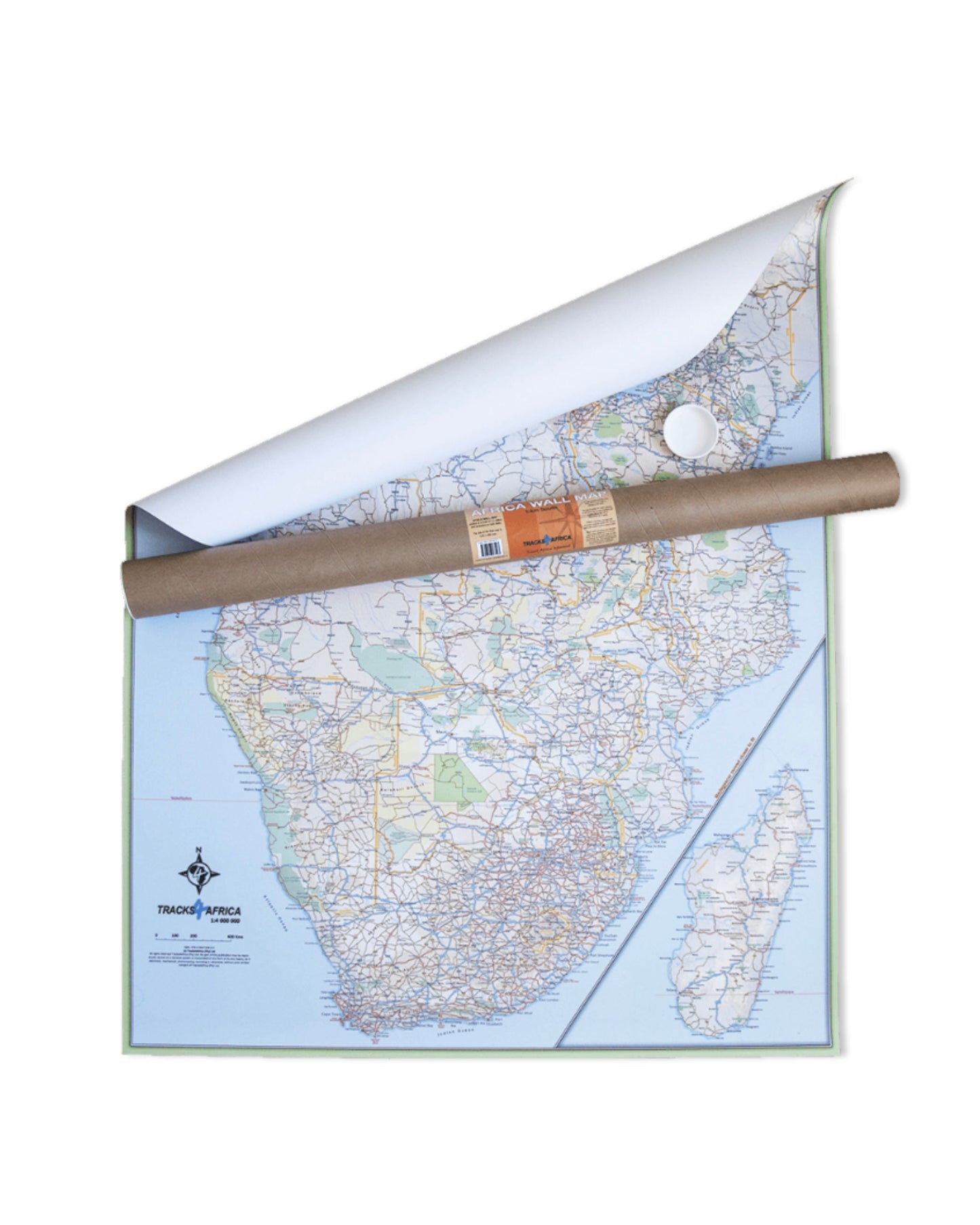
The Tracks4Africa AFRICA WALL MAP is printed at a scale of 1.4 million and laminated on both sides. The size of the final map is 1300 X 980 mm.
The map includes countries from South Africa in the south to Ethiopia in the north.
Perfect for macro planning of self-drive trips through Southern and Eastern Africa and even to West Africa up to Gabon.
Printed in full colour, all major and secondary roads are shown with national parks and country borders clearly visible.
The Tracks4Africa Wall Map is printed to a scale of 1:4million and provides a surprising amount of detail to the self-drive traveller. The map is perfect for macro planning of extended road trips across the African continent up to Ethiopia in the east and Gabon in west. The map indicates major and secondary roads, parks, towns and a good number of tracks in remote areas. Major tourist attractions are indicated where space allows for it. International airports and country borders suitable for vehicle crossings are indicated.
The map covers the area from South Africa in the south to Ethiopia and Gabon in the north. Note that not the entire Ethiopia could be included, but the map stretches as far north as Addis Ababa.
732 g (26 oz) in tube.